Forest Pack
THE ULTIMATE SCATTERING TOOLKIT
RENDER WITHOUT LIMITS

RailClone
ARTIST-FRIENDLY PARAMETRIC MODELLING
UNLIMITED POWER IN YOUR HANDS

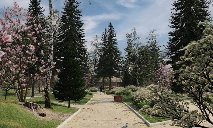
The3dGarden
HIGH QUALITY PLANT MODELS
FULLY INTEGRATED WITH FOREST PACK

TheParametricLibrary
SMART ASSETS FOR BUILDING BETTER WORLDS
EXPAND THE POWER OF RAILCLONE WITH ADAPTABLE PRESETS
Everything you need for artist-friendly scattering, scene assembly, parametric modelling, and procedural layout. Our production proven plugins remove technical barriers and offer users unparalleled artistic control to make world-building a pleasure.
PLUGINS FOR 3DS MAX
INDUSTRY LEADING TOOLS FOR SCATTERING. MODELLING, AND SCENE ASSEMBLY
Forest Pack
Forest Pack is the most powerful scattering plugin on the market for 3ds Max. It provides a complete set of tools for scattering and art directing scene assembly, capable of rendering huge amounts of geometry.
RailClone
The artist-friendly parametric modelling and spline-cloning plugin for 3ds Max that's fast, efficient, and simple. Objects are created by assembling, repeating and deforming geometry using an easy-to-define set of rules.
HIGH QUALITY ASSETS
EXCLUSIVE LIBRARIES THAT WORK FLAWLESSLY WITH OUR PLUGINS
The3dGarden
The3dGarden is our exclusive range of high quality tree and foliage models featuring photo scanned textures and trunks for maximum realism. All our collections are designed to be fully integrated with Forest Pack.
TheParametricLibrary